Cameroon (Cameroun in french reading) was a French and British mandate territory in central Africa, now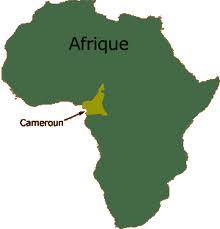 constituting the majority of the territory of the Republic of Cameroon.The area of present-day Cameroon was integrated to French Equatorial Africa (AEF) during the “Scramble for Africa” at the end of the 19th century. However, in 1911 France ceded parts of the territory to German Cameroon, known as Neukamerun (“New Kamerun“) as a result of the Agadir Crisis, and it became a German protectorate. During World War I, it was occupied by British and French troops, and later mandated to each country by the League of Nations in 1922. The British mandate was known as Cameroons and the French as Cameroun. Following World War II each of the mandate territories was made a United Nations Trust Territory. An insurrection headed by Ruben Um Nyobé and the Union of the Peoples of Cameroon (UPC) erupted in 1955, strongly repressed by the French Fourth Republic. Cameroun became independent as the Republic of Cameroun in January, 1960 and in October, 1961 the southern part of British Cameroons joined to form the Federal Republic of Cameroon. The Muslim northern part of Cameroons had opted for union with Nigeria in May the same year. The conflict with the UPC lasted until the 1970s.
Cameroon is now a member of Law of the International Organization and the Commonwealth.Cameroon is a country of the Gulf of Guinea on the west coast of Africa. It has 590 km11 of jagged coastline along the Atlantic Ocean. Extensive latitude (1200 km from north to south), the country schematically the shape of a triangle whose base along the second degree of north latitude, while the top, bordering Lake Chad reached the 13th parallel. Cameroon is a country surrounded by water and extended following:
– Nigeria and the Atlantic Ocean to the west; – Equatorial Guinea, Gabon and the Republic of Congo to the south; – Central African Republic and Chad to the east; – Lake Chad to the north. Its area of 475,442 km212 and a population of about 19,598,889 people in 2010, the Cameroon is a medium-sized country in Africa. The country lies between edge of the Sahara and the northern edge of the rain-forest in the Congo Basin to the south. The west of the country is dominated by the Highlands and includes the tallest mountain of the entire West Africa: Mount Cameroon, which rises to 4095 meters and is the ninth highest peak in Africa . The east of the country is covered in the vast majority of rain-forest still well preserved. Along its 590 km of coastline, there are a few seaside resorts: Kribi and Limbe near Mount Cameroon.
- 1690 km with Nigeria
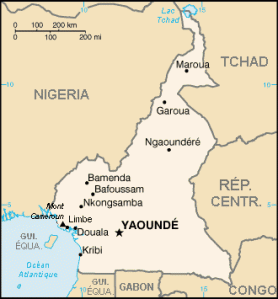
- 1094 km with the Chad
- 797 km with the Central African Republic
- 523 km with the Republic of Congo
- 298 km with Gabon
- 189 km with Equatorial Guinea

